
On Sept. 27 2012, Tony and myself headed off to the Whites for a hike up Edmands Path to the summit of Mount Eisenhower with a trip across the ridge over to Mount Pierce. Unfortunately, we didn't make it over to Mount Pierce due to the weather at the summit of Eisenhower. The weather was perfect, at the base of the mountain. It was 60 degrees and sunny. The Fall colors still were not at peak but the reds, oranges and some yellows were still very beautiful.
We arrive at the trail head around 10am, gear up and head off to the blue-blaze trail about 10:20.

Edmands/Crawford Path Sign

Tony @ the Trail Info Board
A few minutes into the hike and we ran into a couple of small mountain streams and some wooden bridges.

Tony @ Bridge 1

Me @ Bridge 2

Mountain Stream
Edmands path for quite a while was pretty flat and level, but we knew this would change soon.

Edmands Path
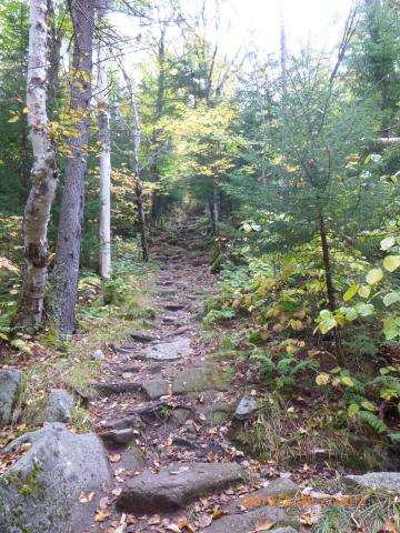
Edmands Path
About 40 minutes into the hike the trail started to get steep, and it didn't let up the entire way. There were almost no switchbacks on this trail.

Me @ the start of the elevation gain

Tony looking up ahead
About 1.5 hours into the hike we got out first view overlooking the valley.

First view from Edmands Path

Another view
As we started to get closer to the summit the winds began to pick up and the temperature really started to drop. It actually felt good on the way up. Being a fat hiker I sweat a lot and the cool Fall breeze helped a lot. The other thing I noticed was how steep it got. The last 1000' or so was a climb.

Starting to get really steep

Another nice view - although a little out of focus

You can't see it, but directly in the center of this photo under the cloud cover is Mount Washington

Mount Franklin from Edmands Path

The weather started to get cold but we kept going

Above tree line

An awful picture of me with Mount Franklin
From the above picture we were about 20 minutes to the summit of Eisenhower. The winds really picked up as this point. Tony was guessing 30mph sustained and 50mph gusts. People coming down from the summit were in winter gear, hats, gloves and thick jackets. Stuff neither Tony or myself brought with us. I did have a cotton hoodie and a wind breaker, but this was just barely enough to stay warm.

The path was very rocky near the top

Summit of Eisenhower

Ridge trail over to Mount Franklin

Last push towards the summit

A nice shot of the ridge trail to Mt. Franklin with Boott Spur in the distance

Boott Spur

Me with Mt. Franklin behind and Boott Spur in the distance to the right

The final push to the summit

Summit of Mount Eisenhower 4,780' behind me to the right behind the cloud cover is Mount Washington.
Once we hit the summit we had something quick to drink and eat, took some pictures and left. There were a couple of other people up there but no one stayed for long. Tony and I stayed at the summit for a total of 13 minutes and then left. If it wasn't so windy it would have been really nice, but the wind made it a lot colder that it was. Next time I'll make sure to have hat and gloves.

Tony descending the summit. Mt. Franklin in the background

One more look at the valley before we leave

Descending from Mt. Eisenhower with the ridge trail over to Mt. Franklin behind

View looking South East (I think)

Final view before we got back into the trees

View as we were leaving the parking lot

GPS track. Mt Pierce to the right, Mt Franklin, Monroe and Washington to the left. Boott Spur behind Washington
Overall is was a very nice hike. I'd like to do it again when it's not so windy and cold so we can traverse over to Mount Pierce or Franklin/Monroe.
Summit of Mount Eisenhower: 4,780'
Total hike time: 5h 30m
Distance: 9 miles
Elevation Gain: 2800'
Trails: Edmands Path