Tony and I head off to the Whites to hike the highest mountain in New England. Today's mission is the Ammonoosuc-Jewell loop. Ammonoosuc Ravine Trail is 3.1 miles from the parking lot to the Lake of the Clouds hut. From the hut you can take Crawford Path over to the summit of Mount Monroe 5,371', head back to the hut and then take Crawford Path over to Mount Washington 6,288'. From Washington we would take the Jewell Trail down 5.1m to the parking lot.
Ammonoosuc Ravine Trail is very steep but has some great water crossings and views near the top. Jewell is a very moderate trail, not very steep at all but it is long at 5.1 mile. Due to long breaks at the summits, hut and me still be an overweight hiker, this would be a long day and we would get down about 30 minutes before the sun went down.
Trailhead sign
Ammonoosuc Trail
Bridge crossing
Gem Pool
Not a very clear picture
Waterfall @ Gem Pool
Clearer picture of Gem Pool
The trail gets very steep and rocky right after Gem Pool
First view from Ammonoosuc Trail
Tony
Waterfalls
More falls
...and more
Starting to gain some elevation
Lots of steep rock scrambles on this trail
Mount Washington in the clouds
Lake of the Clouds Hut @ 5,012'
Mount Monroe 5,371'
Even though it was Aug 11, it was time to put
on jackets at this elevation. It was getting windy and cold
Mount Washington still in the clouds
Looking down at the hut on our way to the summit of Monroe
Summit of Mount Monroe 5,371'
That is Mount Washington behind us
View from summit of Monroe
View from summit of Monroe
Summit of Mount Washington
(clouds blew out)
View coming down from Monroe
On our way to Washington
Looking back at the hut and Monroe
So close, yet so far away
The ridge we crossed
Now looking down on the hut and Monroe
A long way from the hut now
Almost there!
This is NOT the official summit sign
There was a 10 minute wait to get you picture at the official summit!
The official summit sign
It was in the low 30's at the summit - In August!!
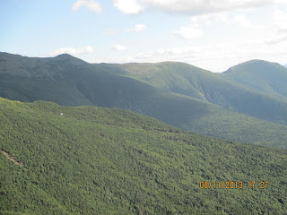
I'm not sure what presidential this is
The trail crosses over the cog railway
Tony with a few of the presidentials
A one way trip down is $45
Left to Right
Mount Clay, Jefferson, Adams, Quincy Adams
Mount Clay
So far away - Mount Monroe
GPS Track #1
GPS Track #2
Summit of Mount Monroe: 5,371'
Summit of Mount Washington: 6,288'
Total hike time (round trip)..: 10h 38m
Elevation Gain.....................: Somewhere around 4000'
Distance (round trip)...........: 11 miles
Trails: Ammonoosuc Ravine Trail, Crawford Path, Jewell Trail


No comments:
Post a Comment