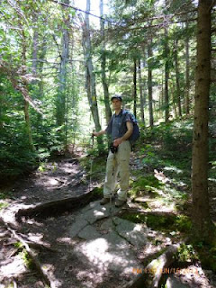
This past weekend, Tom, Tony and myself drove to Mount Kearsarge near Wilmot, NH. Mount Kearsarge is actually located within two state parks, Winslow State Park and Rollins State Park. We pulled into Winslow State Park, paid the $4 per person tax and preceded to get our gear in order.
Mount Kearsarge is 2937' with a bare rock summit and 360 degree views. The summit has remained bare since a forest fire in 1796. There is a fire tower, cell tower and picnic tables at the summit. You can not enter the fire tower but you can climb it to get an even better view. From the tower on a very clear day you can see the skyline of Boston, 80 miles away.
parking lot looking up towards the summit
After gearing up we headed over to the Barlow Trail head. Barlow trail is 1.8 miles with an elevation gain of 1100'. This is not a steep trail at all. Not that I wasn't huffing and puffing on my way up, but after some of the other hikes I have done, this hike was a breeze.
trail head signs for Barlow and Winslow trails
We started our ascent at 12:40pm. As I mentioned this trail is fairly easy with very low elevation gains to start. The trail has your typical New England look to it, lots of rocks and tree roots.
Tom and Tony heading up
After about a 1/2 mile Tony tweaked his back and needed to rest. I should mention this is Tony's first hike, so we picked an easy mountain/trail to do. While we were resting, I took a few shots.
After about 10 minutes Tony insisted that Tom and I continue on our way and that he would catch up. As Tony doesn't yet own a backpack I was carrying his water and snacks. I offered to give them to him but he said no and that he would catch up. So, reluctantly we decided to press on. During the next 20-30 minutes we encountered a few groups of people coming down, all of them said we didn't have much longer to go and that some good views would be coming up very soon.
first good view
small aircraft
After hanging out on the ledge for 10 minutes Tom and I were about to continue on when I saw a bright yellow shirt marching up the trail, Tony! He ended up not being very far behind us.
Tony caught up to us at the first ledge view
We waited another 5 minutes or so to allow Tony to catch is breath and then we preceded onto the summit. At this point were only 15-20 minutes from the top.
a small alpine bog
Tom and I near the summit
summit
me at the summit
fire and cell towers at the summit
Tony enjoying the view!
The views at the summit were not the best, quite a bit of haze off in the distance. You could see Mount Monadnock off to the SouthWest, Mount Ascutney in Vermont to the West, Mount Cardigan to the North. I think we also saw Mount Washington but it was so hazy that it was hard to see. No view of the Boston skyline today either.
After about 20 minutes at the top, the clouds started to move in and the wind was really picking up. I actually wrapped myself in my towel as my sweat was starting to give me the chills. We stayed at the summit for probably 45 minutes to an hour and then started to descend.
Summit of Mount Kearsarge: 2937'
Total hike time (round trip)..: 3h
Elevation Gain.....................: 1100'
Distance (round trip)...........: 3.2 miles


No comments:
Post a Comment