Tony and myself head up to the Lincoln/Woodstock NH area to hike the Mount Flume (4,328') and Liberty (4,459') loop. We leave my driveway in Hudson, NH around 545am and arrived at the trail head a little after 7am. These drives to the Whites are really starting to become routine and we make pretty good time heading up I-93. The weather was a bit cool at around 50 degrees but I'm finding this is almost the perfect hiking temperature. A little cooler might actually be better, I'll find out with tomorrows hike (Mount Moosilauke 4,802') as the high is supposed to be 43 at the base and 40% chance of snow in the morning.
There were a handful of different trails we took but the 3 main trails were the Flume Slide Trail (to the summit of Mount Flume), Franconia Ridge Trail over to Mount Liberty and the Liberty Springs Trail down from the summit of Liberty to the parking lot. While you can go up Liberty and down Flume this is NOT recommended. Any hiker that has done these trails will tell you not to do it and the WMNF Guide book also recommends you do not go down the Flume Slide Trail. The Flume Slide trail is a straight up rock climb, there is really no other way to describe it. It is wet, very steep and long. We ended up going off-trail three times and did a little bushwhacking because the Slide Trail was just to steep and dangerous.

Trailhead Sign

Trailhead
The first 3.8 miles there is very little elevation gain, if any at all. It was constant gain and loss until we reached the base of the Flume Slide which is almost 4 miles from the trailhead. The Flume Slide is an old rock slide that has been grown over with plants and trees and is pretty much always wet and is very steep. From the base of the flume slide, the trail ascends 1,400' in just .7 miles.

Whitehouse Trail Sign

Whitehouse Trail

Cascade Brook? I'm not certain

Almost to Liberty Springs Trail
I should probably just mention all the trails we used so people are not confused. From the parking lot we took the Pemi Trail to Whitehouse Trail to Liberty Springs Trail. Liberty Spring Trail then forks and we go right up the Flume Slide Trail, then left across the ridge trail then down the Liberty Springs trail to Whitehouse, then Pemi then the parking lot. The total hike according to my GPS was 9.93 miles.

The foliage is pretty much gone

Start of Liberty Spring Trail

Liberty Spring Trail

The fork. Left to the summit of Liberty or right to the summit of Flume

Start of Flume Slide Trail

Tony crossing one of many brooks

One of many water crossings

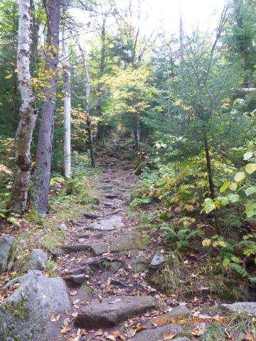
Strange walking the trails with no leaves

Base of the slide starts about here

The pictures don't really show how steep it was getting

More climbing

First view from the slide

Starting to get really steep and wet

Tony assessing the situation

A little bushwhacking

Almost to the summit of Flume!

Summit of Mount Flume 4,328'

Tony checking the view

Both summits - Liberty to the left - Flume to the right

Me checking the view

Mount Lincoln (left) and Mount Lafayette (right) from the summit of Mount Flume. There is snow on top of Lafayette

Mount Washington from Flume

Kellie and I hiked this in July. From left to right,
Mount Haystack, Lincoln and Lafayette from Flume
We didn't spend very long at the summit of Flume, maybe 15-20 minutes, had a snack and something to drink. The wind started picking up but it certainly wasn't anywhere near as bad as when we did Eisenhower. After the short break we geared back up and headed to the ridge trail over to Mount Liberty.

Ridge Trail

Mount Flume from the ridge trail

Last push to the summit of Liberty

Mount Flume and the Ridge from Liberty

Mount Washington from Liberty

Our beers with Mount Lincoln in the background

USGS Marker for Liberty (I couldn't find Flume's)

Cannon from Liberty

Me checking out Flume from Liberty

Tony and I summit of Mount Liberty 4,459'

Descending Liberty

Me with Mount Liberty to my left and Route 3 to the right
On the way down we stopped at the Liberty Springs camp site to see what one of these places looks like. I was impressed actually, I wasn't expecting there to be a platform.

Tent site Sign

AMC Tent Sites on the mountain

GPS Track
This was a great hike although Flume was very difficult. Probably the hardest hike I have done to date. The weather was nice and being a weekday we only ran into a few people. After the hike we went over to Woodstock Brewery and had a few beers and some real food.
Summit of Mount Flume: 4,328'
Summit of Mount Liberty: 4,459'
Total hike time:8h 29m
Distance: 9.93 miles
Elevation Gain: 4235
Trails: Pemi Trail, Whitehouse Trail, Liberty Springs Trail and Flume Slide Trail