Thursday, June 20, 2013

Trail Report: North Pack Monadnock

June 9, 2013

In preparation for Mount Katahdin in July, we have been doing some smaller mountains for some of our friends that have not had much hiking experience or just haven't been on trail in a very long time.  Today's hike was a very small mountain but it still a nice hike with a pretty good view.  North Pack Monadnock 2,276'.

Anyone in decent shape (which I am not) can hike up to this summit in about 1 hour and get back down in 30 minutes.  Due to this mountain not being very far away and not very high up, it is a very popular hike, but not as popular as South Pack.

Ginny, Gary, Mike, Tony

 Trailhead sign

Older trail sign

10 minutes in and Gary needed to cool off!

Some bridges to get over the mud and water

The one and only steep section on this trail

Very slippery on these wet rocks

Ginny and Tony on the one steep section

Say hello to my little friend

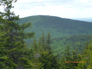
First view along the trail

Close up of first view

Moving along.  This trail is not very difficult

Second view along the trail

Double blaze.  Someone at the summit told us what this meant
but I do not remember

Another steep section, but not really

Another down tree - This is a very common on trail

Almost at the summit

Mount Monadnock from the summit of North Pack 2,276'

Mike, Ginny, Gary, Tony @ the summit of North Pack Monadnock 2,276'

South Pack Monadnock

Summit brews!

Gary & Ginny on the cliff trail
South Pack in the background

GPS Track 1

GPS Track 2

Summit of North Pack Monadnock: 2,276'
Total Hike Time: 2h50m
Distance: 3.85m
Elevation Gain: 994'
Trails: Wapack Trail

Trail Report: North & South Kinsman

May 18, 2013

After a successful failure to summit North and South Kinsman on March 23, 2013 due to snow, high winds and bitter cold temperatures we decided to try and give the Kinsmans another go, this time in much warmer conditions.

You can read about our previous attempt here:
http://hikene.blogspot.com/2013/04/trail-report-kinsman-pond-hike.html


Tony, Tom and myself arrived at the parking lot around 8:30am and began our ascent around 8:47am.  It was a beautiful day, sunny, no clouds and the temps, I believe were in the 60's.

Trailhead sign

The first couple miles of this trail is an old logging road on private land and is mostly flat

I'm not sure what this is, the door was padlocked

I assume the owner of this land is chopping firewood for the coming winter

At the second stream crossing we met a group of people heading up to Bald Peak to do some yoga

Waterfall at the second stream crossing

Tom, Tony, Mike
At the second stream crossing

There was no sign for Bald Peak but the spur trail
for it heads to the right of this sign

I'm not sure what happened here, but this spur trail is all dead trees

Tony @ Bald Peak
Our main destination, North Kinsman stands tall behind Tony

Another great view from Bald Peak
I believe that is Mount Moosilauke to the left

 Another view from Bald Peak

We ran into a couple of these trees that just fell over

We also ran into a couple of these bridges

Around 3200' we ran into some snow

Ridge trail sign

First view since we left Bald Peak

Along the ridge trail

Tony after a small rock scramble

Franconia Ridge from the summit of North Kinsman 4,293'
(Lafayette, Lincoln, Haystack)

View from the summit of North Kinsman
Loon Mountain Ski Area to the far right

 Cannon Mountain from the summit of North Kinsman

Close up of the Franconia ridge

Close up of Mount Lafayette

Tony and Tom @ summit of North Kinsman

Kinsman Pond sits around 3700'

Our next destination, South Kinsman, 4,358'

Beers @ the summit of South Kinsman 4,358'

View from South Kinsman

Another view from South Kinsman

Me @ the summit of South Kinsman 4,358'

Mount Flume and Mount Liberty from South Kinsman

GPS Track pics and stats will be updated here when I get home.  I do not currently have that information with me.

Summit of North Kinsman: 4,293'
Summit of South Kinsman: 4,358'
Distance: 12m
Elevation Gain:
Trails: Mount Kinsman Trail, Kinsman Ridge Trail